About the neighborhood
Suburban area of Manchester, England
Chorlton-cum-Hardy is a suburban area of Manchester, England, three miles (4.8km) southwest of the city centre. Chorlton ward had a population of 14,138 at the 2011 census, and Chorlton Park 15,147.
By the 9th century, there was an Anglo-Saxon settlement here. In the Middle Ages, improved drainage methods led to population growth. In the late Victorian and Edwardian periods, its rural character made it popular among the middle class. The loss of its railway station, the conversion of larger houses into flats or bedsitters, and significant social housing development to the south of the area changed its character again in the 1970s. Chorlton Manchester Metrolink tram stop was built on the site of the former railway station, served by East Didsbury and Manchester Airport trams.
Chorlton was a village on Lancashire's southern border with Cheshire, and a township within the ancient parish of Manchester. It was incorporated into the city of Manchester in 1904. Chorlton borders Stretford, Sale, Didsbury, Withington, and Whalley Range. The River Mersey runs along its southern boundary. The area's eastern boundary has changed since the 19th century because of incorporation into the City of Manchester and division into wards.
History
Toponymy
Chorlton probably means Ceolfrith's farm or settlement from the Old English personal name and tūn, an enclosure, farmstead or village. Hardy is derived from a personal name, Hearda, and ēg, Anglian for island or dry ground in a well-watered land. It has alternatively been suggested that Hardy may mean "by the woods", in reference to the ancient forest of Arden Wood that grew on both sides of the River Mersey in the area. Chorlton was recorded as Chollirton in 1250, Chollerton from 1292 and as Chourton in 1572. It was also noted down as Chawerton on a map of the Salford Hundred by John Speed in 1610.
The ancient hamlets of Chorlton and Hardy, separated by the Chorlton Brook, together with Martledge and Barlow Moor, did not come under the combined name of Chorlton-cum-Hardy (cum is Latin for "with") until the 18th century; local historian Cliff Hayes reports that he can find no mention of Chorlton-cum-Hardy before 1700. The name was adopted by Victorian property developers who arrived in the wake of the coming of the railway in 1880, to distinguish this Chorlton from Chorlton-on-Medlock. The form Chorlton with Hardy was used to some extent from the early 19th century onwards and in the early years of the 20th.
Early history
The district was part of the kingdom of Northumbria from the 7th century, but settlement in the Mersey valley may well have been later. Thomas L. Ellwood suggested 610 AD as the date of founding the settlement, but John Lloyd in his 1972 history considered the period 610 to 900 AD more likely.
The area now known as Chorlton-cum-Hardy comprises the ancient settlements of Chorlton along with Hardy and Barlow to the south on the north side of the Mersey and Martledge, the area around the present-day public library, to the north of Chorlton and Hardy. Chorlton was part of the Withington manor. Hardy was little more than a farm and a few houses, but Barlow was home to the family of that name, who occupied the manor house of Barlow Hall for several hundred years. Barlow Hall was built on a defensive site on rising ground on the north bank of the Mersey. In 1567 the lord of the manor was Alexander Barlow, a staunch recusant who was imprisoned for his beliefs and died in 1584 leaving a son who held similar beliefs. Two of his sons entered the Order of Saint Benedict, one of them, Ambrose Barlow a missionary priest in the Leigh parish, was imprisoned several times and executed for his priesthood in 1641 at Lancaster. Two sons of the papist, Anthony Barlow were charged with treason in the Jacobite rising of 1715. The estate remained with the family until the death of Thomas Barlow in 1773, when it was sold to the Egertons of Tatton Hall. In 1666 Barlow Hall was one of the largest houses paying hearth tax in the Withington manor.
The estimated population in 1640 was 85; in 1714 it was 325. The 1801 census recorded 513 inhabitants, and the 1811 census 619: by 1851 it had increased to 761. The Tithe Commissioners' survey carried out in 1841 provides details of the size and tenure of every piece of land. The tithe map reveals the township had two major landowners: Wilbraham Egerton of Tatton owned 888 acres and George Lloyd 231, the rest was shared between 21 others. Most land was meadow and pasture while 490 acres was arable. Many small landowners owned orchards or market gardens. At this time the village consisted of its ancient halls and scattered farms centred on Chorlton Green and Beech Road and a few buildings on Barlow Moor Road. Its public houses were the Bowling Green, built in 1693, and the Horse and Jockey, which was licensed in the early 19th century.
Marl had been dug in Martledge since at least 1598; the disused pits filled with water gave the area its common name of the Isles. The Chorlton Brick Company was established there in the early part of the 20th century and continued producing bricks for about forty years. Turf-cutting was a significant industry in Martledge, as well as in the White Moss and Jackson's Moss areas.
Suburban growth
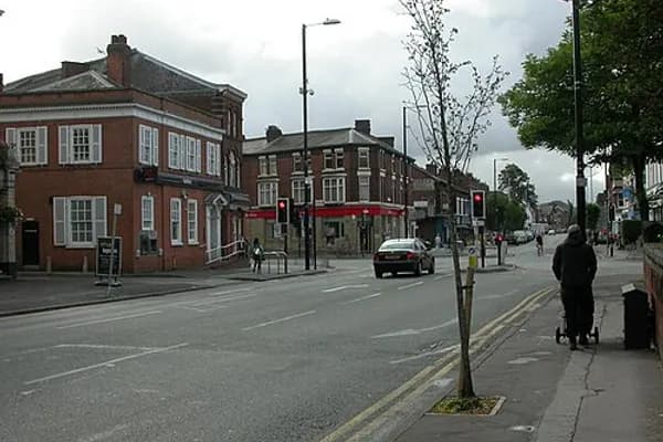
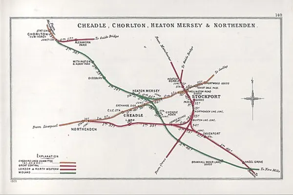
Until the last quarter of the 19th century, Chorlton's population had increased slowly. When the railway reached neighbouring Stretford in 1849, upmarket villas were built on a flood-free area in Edge Lane and High Lane. Wilbraham Road was built in 1869 to connect the Egerton holdings across Withington from Edge Lane to Fallowfield. The Midland Railway built a line from Manchester Central through Chorlton station which opened on 1 January 1880. Over the following decade land close to the station was developed for residential and commercial purposes centred on the Barlow Moor Road/Wilbraham Road crossroads, northeast of the old village centre. Houses built in the 1880s attracted more affluent residents who worked in Manchester city centre to high quality homes in a more rural area. Now that there were two centres reference was sometimes made to Old Chorltonians and New Chorltonians for their respective residents.
Irish immigrants came to work in the expanding industries of Manchester, in small-scale horticulture and farming and domestic service. They brought Roman Catholicism, and by the first decade of the 20th century a church (St Augustine's) and convent school had been established on High Lane.
Further growth was aided by the arrival of Manchester Corporation's tramway before the First World War: a terminus was built on Barlow Moor Road a short distance south of the junction with High Lane. Chorltonville was developed as a garden suburb south of Chorlton Brook: the houses are mostly large and semi-detached and individual in design, standing on tree-lined roads. Alexandra Park Aerodrome (1917–24), was Manchester's first major airfield located east of the Midland Railway overbridge on Mauldeth Road West.
After the First World War came a period of residential development to the east of the new village on either side of Wilbraham Road and a council housing estate at Merseybank. The Ashby, a two-seater light car, was produced in Chorlton-cum-Hardy by Victor Ashby and Son from 1922 to 1924.
From the 1960s onwards a council estate at Nell Lane near Southern Cemetery and patchy redevelopment in other areas were completed. There has been immigration particularly from the Indian subcontinent and from Poland; the Polish community arrived in the 1950s and 1960s.
In 2025 a plan to redevelop the main Chorlton Cross shopping centre with 262 homes, in ten-, eight-, six-, and four-storey blocks was approved by Manchester City Council. This would have 56 one-, 135 two-, and 15 three-bedroom apartments at market rates and 16 one-bed and 33 two-bed flats at affordable rates managed by the Southway Housing Trust.
Governance
Civic history
The district was a township and chapelry in the ancient parish of Manchester in the Salford hundred of Lancashire. The abolition of Withington's manorial rights in the 1840s meant that local government began to be formalised. Chorlton became part of Chorlton Poor Law Union (named after Chorlton-on-Medlock), in 1866 Chorlton cum Hardy became a separate civil parish, in 1894 it became part of Withington Urban District.
From 1876 to 1894 Chorlton was part of the district administered by the Withington Local Board, and from 1894 to 1904 part of Withington Urban District. It was absorbed into the County Borough of Manchester in August 1904, together with the rest of the urban district. A separate Withington Committee of the city council existed from 1904 until 1914. On 1 October 1910 the parish was abolished and merged with South Manchester. In 1901 the parish had a population of 9026.
Boundary with Trafford
In 1987 the Local Government Boundary Commission for England revised the Manchester and Trafford boundary. The most notable differences for Chorlton-cum-Hardy were that Stretford Stadium was now actually in Stretford, and the Jackson's Boat pub in Sale. Other minor adjustments were made in the Turn Moss area.
Political representation
Since the 1970s both of the wards have been in the Manchester Withington parliamentary constituency. Until then Chorlton ward had been in the Manchester Moss Side parliamentary constituency. In the 2015 general election, the Labour Party's Jeff Smith won the seat with 57.3% of the vote unseating the incumbent Liberal Democrat candidate John Leech. Smith was reelected in the 2019 general election and again in 2024.
Most of Chorlton is divided into two wards, Chorlton and Chorlton Park, which includes the Mersey Bank and Nell Lane estates of south and south-east Chorlton. The remainder of the area is included in the Whalley Range ward. As of 2019, each of the three wards is represented by three Labour councillors.
Geography
The ancient township of Chorlton cum Hardy covered 1,280 acres (520ha) of low-lying, flat land on the north bank of the River Mersey. In medieval times the district formed part of the Manor of Withington, an area stretching from Longford Park to Debdale Park and south to the Mersey. The highest land is at the south-east end, where it reaches a little over 100 feet (30m) OD. It is divided by the Chorlton Brook, which runs east to west to its confluence with the Mersey. Chorlton grew north of the brook; the hamlets of Barlow and Hardy were on the southern part, which stretches along the north bank of the Mersey for two miles (3.2km). Because the county boundary was determined by the course of the Mersey, it traditionally did not exactly follow the river when it changed course: this happened occasionally in the period before improved flood control measures were introduced in the 1840s. The Manchester–Trafford boundary now follows the course of the river. Chorlton is surrounded by Stretford, Sale, Didsbury, Withington, and Whalley Range.
Chorlton's climate is generally temperate, with few extremes of temperature or weather. The mean temperature is slightly above average for the United Kingdom. Annual rainfall and average amount of sunshine are both slightly below the average for the UK.
Between Chorlton Brook and the river, Chorlton Ees Nature Reserve occupies the site of Withington sewage works which closed in 1972. The derelict site was restored and has a network of trails through its grassland and woodland. In the 1970s, gravel was extracted from the Mersey floodplain at Barlow Hall Farm and used in the construction of the M60 motorway. The area around the flooded gravel pit was restored as Chorlton Water Park and is now a Local Nature Reserve.
Chorltonville, a garden village covering 36 acres (15ha), was developed in 1911 south of Chorlton Brook and became the home of professional classes who moved into the area.
Demography
Population change
Economy
Chorlton Precinct, built in the 1970s and rebranded as "The Square" in 2009, has been the subject of redevelopment plans. In 2010 Manchester City Council's South Manchester Regeneration Team issued an action plan for improvements to the "Chorlton District Centre" for the period 2010 to 2020. It proposes investment in the district aimed at creating "a strong, vibrant and successful centre that supports the local community and has the ability to exploit the economic potential of Metrolink". In 2023 plans were formulated to redevelop the site of the shopping centre, the office block Graeme House and the municipal car park at Nicolas Road. As of April 2025 a leaflet entitled "Our first conversation" has been issued to the public.
Government and public sector employers in Chorlton include the Department for Work and Pensions, Manchester Mental Health and Social Care, and Manchester Social Services. The district centre has a library, a health centre, three dentists and a bank.
In 2014 insurance claim figures revealed that the M21 postcode, encompassing Chorlton-cum-Hardy, was the most burgled postcode in the UK with 45.2 claims per 1,000 people.
Landmarks
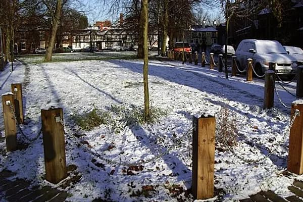
Manchester City Council designated Chorlton Green a conservation area in 1970 and Chorltonville in 1991.
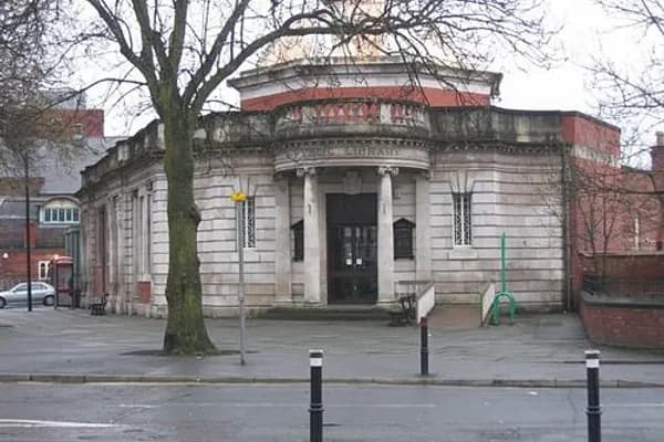
Chorlton Library
Chorlton Library was built in 1914 to a design by Manchester City Council architect Henry Price. It was funded by a £5000 donation from steel magnate and philanthropist Andrew Carnegie, one of about 3000 Carnegie libraries around the world. The single-story flat-roofed building is constructed of red brick dressed with Portland stone, and is designed in the Edwardian Baroque style.
In 2013 Manchester Council announced plans to sell the library after its reorganisation of the provision of leisure and library services in Chorlton into a new £5.7 million "joint service centre" to be built on the site of Chorlton shopping precinct. Fears that the library would then be demolished were allayed when on 21 August 2013 it was designated a Grade II listed building following a campaign by local Liberal Democrat councillor Victor Chamberlain.
A renovation project designed to enhance and preserve the building was completed in 2025.
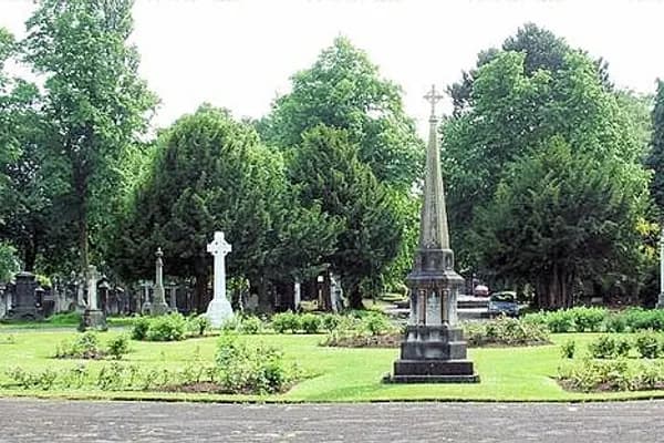
Southern Cemetery
Encyclopedic content adapted from the Wikipedia article on Chorlton, used under CC BY-SA 4.0.