About the neighborhood
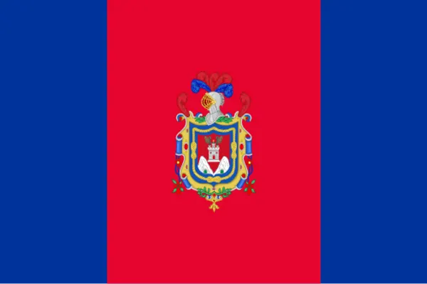
Capital city of Ecuador
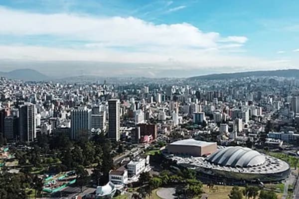
Quito (Spanish pronunciation: ˈkito ; Quechua: Kitu), officially San Francisco de Quito, is the capital and second-largest city of Ecuador, with an estimated population of 2.8 million in its metropolitan area. It is also the capital of the province of Pichincha. Quito is in a valley on the eastern slopes of Pichincha, an active stratovolcano in the Andes.
Quito's elevation of 2,850 meters (9,350ft) makes it either the highest or the second-highest national capital city in the world. This varied standing is because Bolivia is a country with multiple capitals; if La Paz is considered the Bolivian national capital, it tops the list of highest capitals, but if Sucre is specified as the capital, then it is the second-highest, behind Quito.
Quito is the political and cultural center of Ecuador as the country's major governmental, administrative, and cultural institutions are within the city. The majority of transnational companies with a presence in Ecuador are headquartered there. It is also one of the country's two major industrial centers—the port city of Guayaquil being the other one.
The date of its first habitation is unknown, but archaeological evidence suggests that it was first settled by sedentary populations between 4400 and 1600 BC. In the late fifteenth century, the Inca Emperor Huayna Capac defeated the Quitu, the region's original inhabitants, and incorporated Quito into the Inca Empire, designating it into the capital of the Inca Empire's northern region. The Spanish conquest of the city in 1534 is the date most frequently cited as the city's official founding, making Quito the oldest capital in South America.
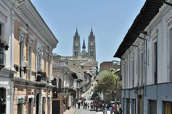
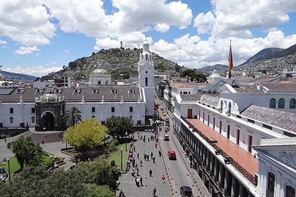
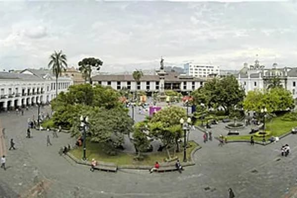
Quito's historic center is among the largest and best-preserved in the Americas. In 1978, Quito and Kraków were the first World Cultural Heritage Sites declared by UNESCO. Quito is the capital city closest to the Equator, which runs through the northern part of the metropolitan area in the parish of San Antonio.
History
Pre-Columbian period
The oldest traces of human presence in Quito were excavated by American archeologist Robert E. Bell in 1960, on the slopes of the Ilaló volcano, located between the eastern valleys of Los Chillos and Tumbaco. Hunter-gatherers left tools of obsidian glass, dated to 8000 BC. This archeological site, called EI Inga, was brought to Robert Bell's attention by Allen Graffham. As a geologist in Ecuador, Graffham pursued his amateur interest in archeology. He made surface collections at the site during 1956. The discovery of projectile points, particularly specimens with basal fluting, stimulated his interest, and he made several visits to the site to collect surface materials. Graffham's previous interest in Paleo-Indian remains, and his experience with early human-made materials in Kansas and Nebraska in the Central Plains of the United States, led him to believe that the site was an important discovery.
The second important vestige of human settlement was found in the current neighborhood of Cotocollao (1500 BC), northwest of Quito. The prehistoric village covered over 26 hectares in an area irrigated by many creeks. Near the ancient rectangular houses, there are burials with pottery and stone offerings. The Cotocollao people extracted and exported obsidian to the coastal region.
The priest Juan de Velasco wrote about a Kingdom of Quito. His source was a lost work by Marcos de Niza, the existence of which has not been confirmed. His account said that another people, known as the Cara or the Schyris, came from the coast and took over the entire region by AD 890. He goes on by saying that this kingdom lasted until the Inca took over the territory in the 15th century. However archeological evidence does not indicate unity among the different ethnic groups in the region. The local Quitu or Quillaco tribe is distinct in its art and architecture from its neighbors.
By the 20th century, many prominent historians who began more academic studies, doubted the account of the Quitu-Cara kingdom. They think it was a legendary pre-Hispanic account of the highlands. These days, most historians deny the existence of the kingdom of Quito in favor of a more fragmented region. The Quitu ruled over Quito at the time of the Inca invasion by Topa Inca Yupanqui under the reign of his father. In the early 21st century, there were spectacular new finds of 20-meter deep tombs in the La Florida neighborhood of Quito. Dating to AD 800, they provide evidence of the high quality of craftsmanship among the Quitu, and of the elaborate and complex character of their funerary rites. In 2010, the Museo de Sitio La Florida opened to preserve some of the artifacts from the tombs and explain this complex culture.
Colonial period
Incan uprising against the Spanish continued during 1534. The conquistador Diego de Almagro founded Santiago de Quito (in present-day Colta, near Riobamba) on 15 August 1534, renamed as San Francisco de Quito on 28 August 1534. The city was later refounded at its present location on 6 December 1534 by 204 settlers led by Sebastián de Benalcázar, who captured leader Rumiñahui, effectively ending all organized resistance. Rumiñahui was executed on 10 January 1535.
On 28 March 1541, Quito was declared a city. Further, on 23 February 1556, it was given the title Muy Noble y Muy Leal Ciudad de San Francisco de Quito ("Very Noble and Loyal City of San Francisco of Quito"), marking the start of its next phase of urban development. In 1563 Quito became the seat of a Real Audiencia (administrative district) of Spain. It was classified as part of the Viceroyalty of Peru until 1717, after which the Audiencia was part of the new Viceroyalty of New Granada. Under both Viceroyalties, the district was administered from Quito, (see Real Audiencia de Quito).
The Spanish established Roman Catholicism in Quito. The first church (El Belén) was built before the city was officially founded. In January 1535 the San Francisco Convent was constructed, the first of about 20 churches and convents built during the colonial period. The Spanish converted the indigenous population to Christianity and used them as labor for construction.
In 1743, after nearly 210 years of Spanish colonization, Quito was a city of about 10,000 inhabitants. Quito briefly proclaimed its de facto independence from Spain between 1765 and 1766 during the Quito Revolt. On 10 August 1809, a movement was again started in Quito to win independence from Spain. On that date a plan for government was unveiled, which appointed Juan Pío Montúfar as president and prominent pro-independence figures in other government positions.
This initial movement was defeated on 2 August 1810, when colonial troops arrived from Lima, Peru, and killed the leaders of the uprising and about 200 other settlers. A chain of conflicts climaxed on 24 May 1822, when Antonio José de Sucre, under the command of Simón Bolívar, led troops into the Battle of Pichincha, on the slopes of the volcano. Their victory established the independence of Quito and the surrounding areas.
Republican Period
In 1833, members of the Society of Free Inhabitants of Quito were assassinated by the government after they conspired against it. On 6 March 1845, the Marcist Revolution began. In 1875 the country's president, Gabriel García Moreno, was assassinated in Quito. Two years later, in 1877, Archbishop José Ignacio Checa y Barba was killed by poison while celebrating Mass in Quito.
In 1882, insurgents rose up against the regime of dictator Ignacio de Veintimilla. However, this did not end the violence that was occurring throughout the country. On 9 July 1883, the liberal commander Eloy Alfaro participated in the Battle of Guayaquil, and after further conflict he became the president of Ecuador on 4 September 1895. Upon completing his second term in 1911, he moved to Europe. He returned to Ecuador in 1912 and attempted to return to power unsuccessfully; he was arrested on 28 January 1912, and imprisoned, then lynched by a mob that stormed the prison. His body was dragged through the streets of Quito to a city park, where it was burned.
In 1932, the Four Days' War broke out. This was a civil war that followed the election of Neptalí Bonifaz and the subsequent realization that he carried a Peruvian passport. On 12 February 1949, a realistic broadcast of H. G. Wells' novel The War of the Worlds led to citywide panic, and the deaths of more than twenty people who died in fires set by mobs.
The historic center Quito was established as a UNESCO World Heritage Site in 1978, on the inaugural UNESCO session dedicated to the World Heritage.
21st century
In 2011, the city's population was 2,239,191 people. Since 2002, the city has been renewing its historic center. The old airport was closed to air traffic on 19 February 2013. The area was redeveloped as "Parque Bicentenario" (Bicententennial Park). The new Mariscal Sucre International Airport, a 45-minute drive from central Quito, opened to air traffic on 20 February 2013.
During 2003 and 2004, the bus lines of the Metrobus (Ecovia) were constructed, traversing the city from the north to the south. Many avenues and roads were extended and enlarged, depressed passages were constructed, and roads were restructured geometrically to increase the flow of traffic. A new subway system opened with one line on 1 December 2023.
In 2023, presidential candidate Fernando Villavicencio was assassinated after a rally in Quito.
In 2025, a landslide caused a water pipe to break, disrupting water access for 400,000 residents, or 13% of Quito's population, and causing the worst water crisis in 25 years.
Geography
Quito is in the northern highlands of Ecuador in the Guayllabamba river basin. The city is built on a long plateau lying on the east flanks of the Pichincha volcano. The valley of Guayllabamba River where Quito lies is flanked by volcanoes, some of them snow-capped, and visible from the city on a clear day. Quito is the closest capital city to the equator. Quito's altitude is listed at 2,820 meters (9,250ft).
Nearby volcanoes
Quito's closest volcano is Pichincha, looming over the western side of the city. Quito is the only capital city that was developed so close to an active volcano. Pichincha volcano has several summits, among them Ruku Pichincha at 4,700 meters (15,400ft) above sea level and Guagua Pichincha at 4,794 meters (15,728ft).
Pichincha is active and being monitored by volcanologists at the Geophysical institute of the national polytechnic university. The largest eruption occurred in 1660 when more than 25 centimeters (9.8in) of ash covered the city. There were three minor eruptions in the 19th century. The latest eruption was recorded on 5 October 1999, when a few puffs of smoke were seen and much ash was deposited on the city.
Activity in other nearby volcanoes can also affect the city. In November 2002 the volcano Reventador erupted and showered the city in fine ash particles, to a depth of several centimeters.
The volcanoes on the Central Cordillera (Royal Cordillera), east of Quito, surrounding the Guayllabamba valley, include Cotopaxi, Sincholagua, Antisana and Cayambe. Some of the volcanoes of the Western Cordillera, to the west of the Guayllabamba valley, include Illiniza, Atacazo, and Pululahua (which is the site of the Pululahua Geobotanical Reserve).
Climate
Quito features a subtropical highland climate with uniform precipitation (Köppen: Cfb, Trewartha: Cfll). Because of its altitude and location on the equator, Quito has a fairly constant cool but comfortable climate. The average afternoon maximum temperature is 21.4°C (70.5°F), and the average night-time minimum temperature is 9.8°C (49.6°F). The annual average temperature is 15.6°C (60.1°F). The city has only two seasons: dry and wet. The dry season, June through August (3 months), is referred to as summer; the wet season, September through May (9 months), is referred to as winter. Annual precipitation, depending on location, is over 1,000 millimeters (39in).
Due to its altitude, Quito receives some of the greatest solar radiation in the world, sometimes reaching a UV Index of 24 by solar noon under clear skies.
The fact that Quito lies almost on the equator means that high pressure systems are extremely rare. Pressure is stable, so very low pressure systems are also rare. From 1 July 2010 to 30 June 2011 the lowest pressure recorded was 998.2 hectopascals (29.48inHg), and the highest was 1,015.2 hectopascals (29.98inHg). Despite the absence of high pressure, Quito can still experience settled weather. Generally, the highest pressure is around midnight and the lowest in the mid-afternoon.
Water
The vast majority of Quito's water comes from the paramo, high-altitude grass and shrublands above the tree line but below the snow. In the 1990s, facing water shortages, the Quito Water Company (EPMAPS) partnered with The Nature Conservancy to start FONAG (Fund for the Protection of Water in Spanish) to preserve these paramos, which includes moving cattle and sheep to graze elsewhere, and protecting it from slash and burn agriculture, and mining companies.
Topographical zones
Quito is divided into three areas, separated by hills:
Central: houses the colonial old city.
Southern: is mainly an industrial and working-class residential area.
Northern: is the modern Quito, with high-rise buildings, shopping centers, the financial district, and a mix of upper-class, middle-class, and working-class residential areas.
Economy
Quito is the largest city in contribution to national GDP, and the highest in per capita income. Quito has the highest level of tax collection in Ecuador, exceeding the national 57% per year 2009, currently being the most important economic region of the country, as the latest "study" conducted by the Central Bank of Ecuador.
The top major industries in Quito includes textiles, metals and agriculture, with major crops for export being coffee, sugar, cacao, rice, bananas and palm oil.
Petroecuador, the largest company in the country and one of the largest in Latin America is headquartered in Quito.
Headquarters and regional offices of many national and international financial institutions, oil corporations and international businesses are also in Quito, making it a world class business city.
In "The World according to GaWC" global cities report, which measures a city's integration into the world city network, Quito is ranked as a Beta city: an important metropolis instrumental in linking its region or state into the world economy.
Politics
Governance
Quito is governed by a mayor and a 15-member city council. The mayor is elected to a five-year term and can be re-elected. The position also doubles as Mayor of the Metropolitan District of Quito (the canton). The current mayor is Pabel Muñoz Lopez.
Urban parishes
Encyclopedic content adapted from the Wikipedia article on Centro Histórico, used under CC BY-SA 4.0.